

Look for the blue banner below and read this entry in English!
Guerrilleros es un juego de escala estratégica en donde el ‘teatro’ principal es la España peninsular. En esta entrada describiré la zona central del tablero. Esto es: el mapa, su estructuras, sus omisiones y la optimización del mismo a lo largo de las iteraciones que va sufriendo a medida que desarrollo el juego. Dejaré para más adelante la zona externa del tablero, que contiene medidores referidos principalmente a los diferentes aspectos estratégicos de ambos bandos.
IMPORTANTE: todo lo que describo debajo es trabajo en desarrollo. Por tanto:
- El cuerpo principal del juego está TERMINADO – salvo que aparezca algo que obligue a revisar algún aspecto.
- Las mecánicas son robustas pero están ABIERTAS a ser pulidas según se va probando el juego y encontrando lagunas o situaciones que puedan provocar desequilibrios indeseados.
- Los diseños NO SON DEFINITIVOS así que ninguna de las imágenes que verás debajo está en su versión final. Todos los componentes tendrán un diseño muchísimo mejor de lo que verás en estos diarios.
- En cuanto al idioma, todo lo que está escrito en castellano será TOTALMENTE traducido al inglés para la versión final, así que además de la versión en castellano, podréis contar con una versión completa del juego en inglés (reglas, componentes, cartas, mapa… ¡todo!).
Dicho esto, si te apetece conocer más sobre el escenario donde se juega Guerrilleros, ¡sigue leyendo!
El tablero de Guerrilleros
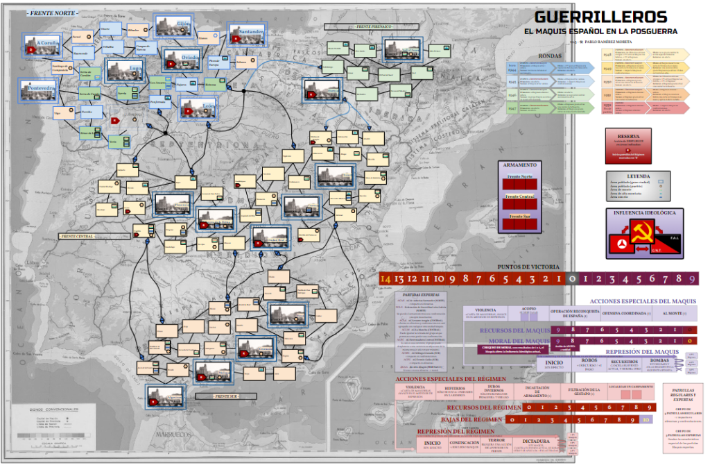
Entre otras muchas cosas, elaborar un buen tablero para un juego es una tarea ardua y en la que no me considero especialmente bueno. El diseño que muestro debajo es provisional y claramente mejorable. Sin embargo, para los propósitos de esta (larga) etapa de desarrollo y testeo del juego, me parece que es suficientemente funcional ya que contiene todo lo imprescindible. También añado que no tengo ninguna duda de que, para su diseño final, un buen diseñador gráfico lo mejorará varios órdenes de magnitud.
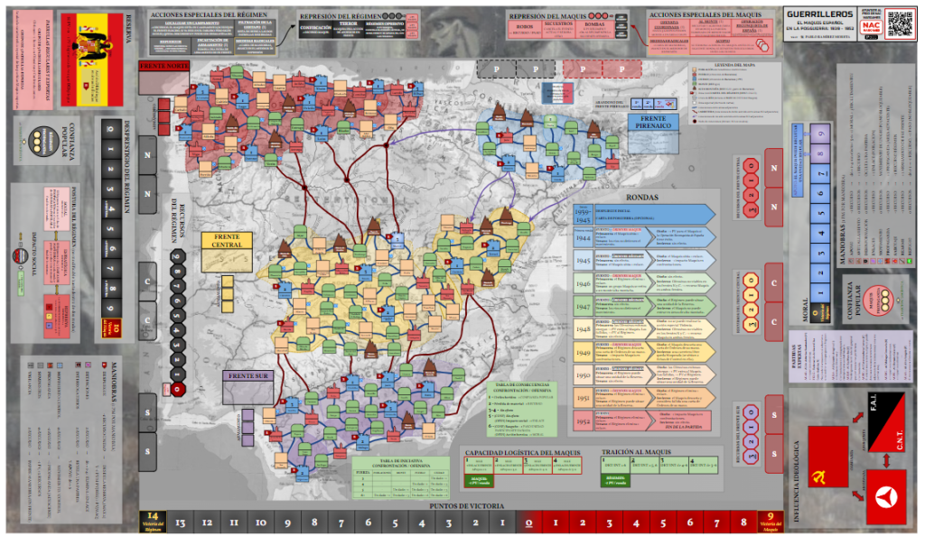
En esta versión (la número 4.0 desde su boceto más inicial, lejos del que captó el interés de NAC), he dividido el tablero en dos zonas: la zona central (mapa de España) y la zona exterior (medidores y cajas).
En esta entrada, hablaré de la zona central, del mapa de España y sus características. La zona exterior la trataré en otra entrada aprovechando la explicación de algunas mecánicas.

El mapa de España
Centrándonos en el mapa y sus casillas, esta zona constituye el área de juego principal donde se distribuirán, moverán, lucharán y huirán las unidades de ambos bandos.
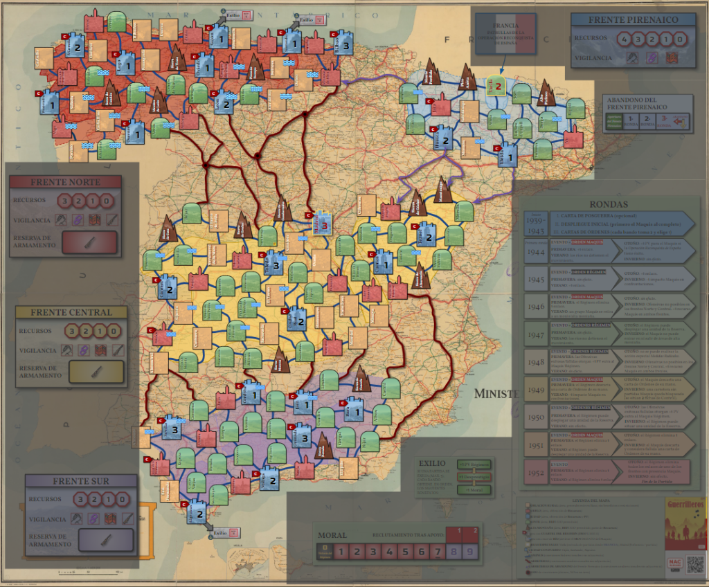
En el mapa se distinguen diferentes elementos: frentes, áreas y carreteras.
FRENTES PRINCIPALES: NORTE, CENTRAL Y SUR
La actividad del Maquis no se definió en «frentes» como los que presento en este mapa con un sombreado de color rojo (Norte), amarillo (Central) y morado (Sur). Históricamente, no hubo frentes con sus líneas de frente, retaguardia, línea de suministros, etc., sino extensiones de diferente tamaño y orografía donde los guerrilleros se escondían, realizaban su actividad y que variaron mucho con el paso de los años.


Es importante añadir que entre las diferentes fuentes que he consultado no existe una única, precisa y unánime versión de lo que se consideran las áreas de actividad del Maquis. Por esa razón, en este mapa he optado por usar los frentes como una sintetización de ambos hechos: uno, que las zonas de actividad eran concretas, más locales que globales, y otro, que hubo suficiente presencia maquis en tantas zonas de diferente tamaño (aunque fuera por poco tiempo), que es difícil demarcarlas en áreas muy específicas.
Además, usando esta ambigüedad como pretexto, me he permitido extender las «fronteras» de esos frentes, sin otro objetivo que el de facilitar la experiencia del juego.
Finalmente, he intentado que el mapa contenga de forma sutil esta información sobre las zonas de actividad histórica o no: en cada frente, las zonas históricamente más precisas están delimitadas con una línea sólida y un color más saturado, mientras que las zonas deliberadamente extendidas por mí presentan un color mas suave y se delimitan por una línea rayada.

Entonces, ¿cuál es la función de los frentes?
En Guerrilleros, estos frentes son una aproximación geográfica francamente conveniente para ofrecer jugabilidad y añadir la componente «local» de las actividades de las diferentes Agrupaciones Guerrilleras (abreviadas AG) – componente totalmente irrelevante para el Régimen, que la puede (¡y debe!) ignorar salvo excepciones.
En pocas palabras, los frentes representan zonas del mapa que comparten una serie de propiedades y características que afectan principalmente al bando del Maquis y que enumero a continuación:
- DESPLIEGUE DE BLOQUES. Las partidas de las AG Maquis de cada zona de España se despliegan en su respectivo frente (se indica en cada bloque): las del norte de España se despliegan en el Frente Norte, así como las del Central y del Sur en sus respectivo frentes.
- PARÁMETROS COMUNES. Hay ciertos parámetros que están abstraídos y colectivizados, como son los Recursos o el Armamento, disponibles y compartidos por todas las partidas Maquis del frente. Estos parámetros pretenden representar de forma promediada la capacidad logística y militar de las AG y partidas del frente, y no pretenden sugerir que hubiera una gran infraestructura logística o armamentística común para grandes áreas, mucho menos del tamaño de un frente. Simplemente aglomeran las menguantes capacidades de las partidas Maquis a lo largo del tiempo.
- MANIOBRAS. A la hora de jugar Cartas de Maniobra, mecánica principal del juego, se pueden asignar maniobras a cada frente, para resolverlas posteriormente.
- POSIBLE CONDICIÓN DE VICTORIA DEL RÉGIMEN. Los frentes además constituyen elementos estratégicos para el bando del Régimen que puede ganar la partida si consigue eliminar el último bloque del Maquis en dos de los tres frentes principales.
Falta por comentar un frente más, el Pirenaico. Tras ello, decribiré los tipos de casillas de los frentes.
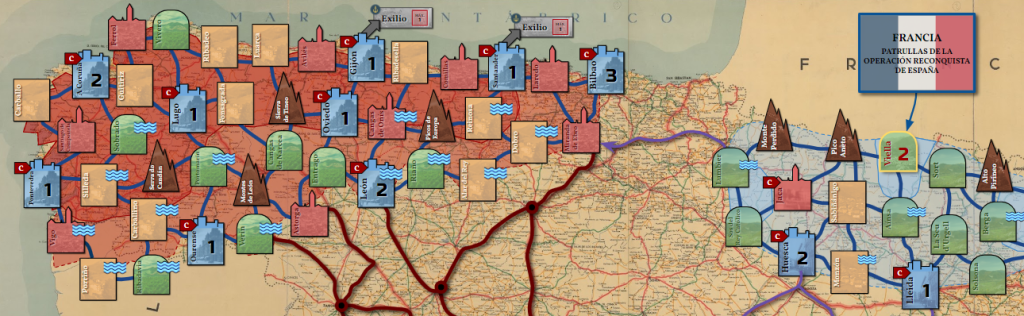
FRENTE TEMPORAL: PIRENAICO
La naturaleza del Frente Pirenaico es especial o, mejor dicho, «temporal«. La apertura de este frente ocurre si se lleva a cabo la invasión de la Vall d’Aran por parte del Maquis, también conocida como «Operación Reconquista de España«. En el juego, esta operación es usualmente iniciada por el Maquis aunque también el Régimen puede forzar su detonación.
En el momento en que esta operación comienza, el resto de frentes quedan en suspenso y la atención se centra única y exclusivamente en este frente hasta que termine la operación (tal y como indica el medidor de «Abandono del Frente Pirenaico«). Este parón se debe a que la Operación Reconquista de España duró apenas unos pocos días, del 19 al 24 de Octubre de 1944, y este lapso no encaja con el ritmo temporal de una ronda normal de juego, establecida en 6 meses. Por tanto, durante las siguientes tres rondas (conservando casi toda la estructura de una ronda normal), sólo se jugará con las partidas y patrullas del Frente Pirenaico. Cuando este frente se cierre al final de la última ronda del medidor de Abandono, las partidas que lo hayan abandonado podrán seguir jugando en otros frentes y se eliminarán las que no lo hayan conseguido. Por su lado, el Régimen enviará a la Reserva las patrullas que hayan sido destinadas al Frente Pirenaico. Entonces, el juego se reanuda de forma normal comenzando con la siguiente ronda.

Una de las condiciones de victoria del Régimen es eliminar la presencia de partidas del Maquis en dos de los tres principales. Por tanto, recalco la cualidad de temporal del Frente Pirenaico a la vez que no computable para tales condiciones de victoria.
CASILLAS DEL MAPA: ÁREAS
Las localizaciones de diferente color y contorno componen las casillas donde se situarán las partidas y patrullas del juego. En el juego son llamadas «áreas» porque representan extensiones de entre 5 y 10 km a la redonda respecto al nombre anotado en la casilla. Es decir, cada área debe entenderse NO como la localización mencionada sino como las inmediaciones en torno a ese lugar, una extensión variable de km cuadrados en torno a cada área.
Por ejemplo: «Dobro«, población rural burgalesa del Frente Norte, no se refiere específicamente al pueblo de Dobro como tal, sino que debe entenderse como las inmediaciones de Dobro.
TIPOS DE ÁREA
Una vez aclarada la escala de las áreas, continúo describiendo los tipos de áreas que se pueden encontrar en todos los frentes.

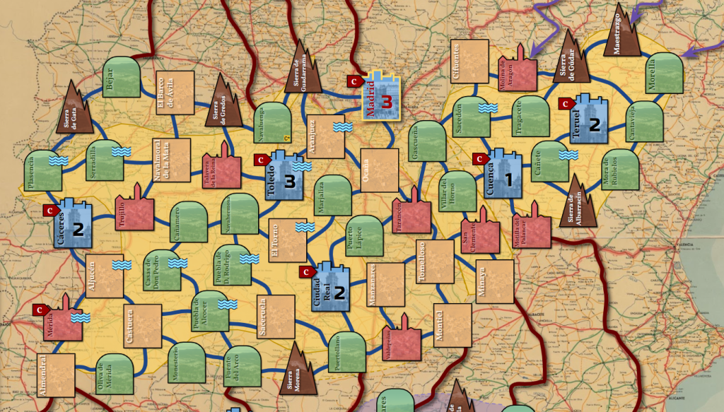
Área de POBLACIÓN RURAL, de color naranja claro y que representa áreas en torno a pueblos pequeños, en general particularmente escasos de agentes o zonas geográficas relevantes para el Maquis. En la imagen: El Barco de Ávila o Navalmoral de la Mata.
Área de PUEBLO, de color rojo y que representa extensiones en torno a pueblos de mayor entidad o relevancia para los propósitos del Maquis (avituallarse, hacer propaganda…). En la imagen: Trujillo.
Área de CIUDAD, de color azul y con un número que representa la resistencia intrínseca de la ciudad así como potenciales Puntos de Victoria. Las Ofensivas (ataques del Maquis para recibir PV) sólo pueden realizarse en las casillas que tengan un valor. Estas son todas las ciudades y Viella en el Frente Pirenaico. En la imagen: Cáceres.
Área de MONTE, de color verde, que representa áreas en torno a poblaciones de tamaño variable pero siempre con una elevada y relevante presencia de montes a su alrededor, claves para el Maquis. En la imagen superior: Béjar, Plasencia, Serradilla o Cañamero.
Área de ALTA MONTAÑA, de color marrón, accesibles únicamente por el Maquis y que exige gasto de recursos o pérdida de pasos. En la imagen superior: la Sierra de Gata.
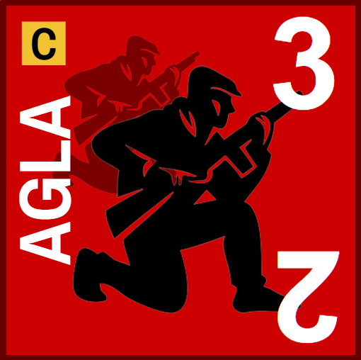
Áreas con CUARTEL DEL RÉGIMEN, indicadas con una flecha roja que contiene una «C» blanca, presentes en todas las ciudades y algunos pueblos, son las áreas en las que el Régimen puede desplegar patrullas desde la Reserva. En la imagen superior: Cáceres.
Áreas con presencia de uno o varios RÍOS caudalosos, indicados con un símbolo azul a la derecha del área, que presentan un problema para el movimiento del Maquis, y son ignorados por el bando del Régimen. En la imagen superior: Plasencia o Serradilla.

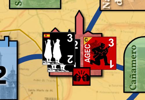
Áreas ESPECIALES, indicadas con el borde de color amarillo. En concreto hay dos: Madrid (Frente Central) y Viella (Frente Pirenaico). Son áreas con puntuación posible que pueden ser parte de una Ofensiva del Maquis sólo si se dan las condiciones adecuadas. Estas condiciones se indican en algunas de las cartas y hasta que no son leídas y sus efectos llevados a cabo, ambas áreas permanecen fuera de juego. En la imagen de la izquierda: Viella.

Áreas de CIUDAD CON PUERTO, indicadas con un símbolo de un ancla y una flecha que indica la posibilidad de exilio de las partidas que hagan uso de él. En la imagen de la derecha: Algeciras.
CONEXIONES ENTRE ÁREAS Y FRENTES: CARRETERAS
Las conexiones directas entre áreas de un mismo frente (áreas adyacentes) están indicadas por líneas azul oscuro. Estas conexiones son transitables por ambos bandos y si bien no representan ningún camino o carretera concreto, sí están dispuestos entre áreas relativamente cercanas. Si un área no presenta una conexión con otro área aparentemente cercana, es posible que se deba a que o bien no están tan cerca como parece por su situación en el mapa, o bien existe algún accidente geográfico que dificulta su tránsito hasta el punto de hacer tal ruta inviable.

Llamadas carreteras por simplicidad, las conexiones entre áreas de dos frentes diferentes (áreas NO adyacentes), también llamadas conexiones entre frentes, y se indican por líneas marrones o moradas. Estas conexiones pueden tener uno o dos tramos, son transitables sólo por el bando del Maquis y es la única forma de que una partida pueda viajar de un frente a otro. Los tramos de una carretera se definen como la porción de linea entre un área y a) otro área, o b) un nexo de unión de tramos (figura circular de núcleo negro; NO cuenta como área). Cada tramo de carretera representa una «casilla» de la misma, por lo que el bando del Maquis deberá gastar puntos de maniobra de forma usual para mover las partidas a través de cada tramo, hasta llegar al área destino. Por su parte, el Régimen ignora las carreteras. Esto se debe a que, lógicamente, ese bando puede mover sus tropas por todo el mapa con mucha mayor libertad. Para mover patrullas desde cualquier punto a otro del mapa, deberá usar la maniobra de Desplegar dos veces para, primero, mover tropas a la Reserva y segundo, desplegar esas u otras tropas en cualquier otro área del tablero que contenga un Cuartel.

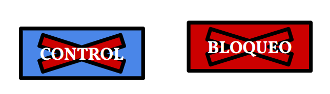
Además, el Régimen puede establecer Controles o Bloqueos en las carreteras que, respectivamente, dificulten o eviten el movimiento de las partidas a través de los tramos afectados.

Las carreteras moradas son exactamente iguales, con la particularidad de que sólo son transitables una vez y en la dirección indicada por la flecha, actuando como las vías de escape de las partidas del Maquis tras detonarse la Operación Reconquista de España. Asímismo, el bando del Régimen podrá establecer controles o bloqueos en ellas únicamente durante las rondas en que la Operación se lleve a cabo.
OMISIONES EN EL MAPA
No he recibido ningún comentario a este respecto pero me apetece abordar este tema con claridad y antes e que nadie malentienda nada al respecto: el juego no contiene todo el saber, hechos, lugares o elementos de la guerrilla. Y eso está bien.
Algunos párrafos arriba mencionaba mi decisión de aglutinar las diferentes áreas de actividad de la guerrilla en los que he llamado Frentes Norte, Central, Sur y Pirenaico para favorecer la jugabilidad. Con esta decisión soy consciente de que he dejado fuera de esas fronteras numerosos lugares en los que hubo presencia y actividad del Maquis, independientemente de su intensidad o extensión: archipiélagos balear y canario, zonas del interior o de las costas con actividad más localizada, etc.
Detrás de la decisión de omitir lugares donde pudo haber o hubo con certeza actividad de la guerrilla no hay ninguna intención más allá de de la de establecer límites al juego – como cualquier otro. Por tanto, tales omisiones carecen de cualquier matiz geográfico, ideológico o de cualquier otro tipo.
En pocas palabras, el diseño dicta sus propias limitaciones (¡y eso está bien!). Algunas pueden solventarse pero otras requieren ser sacrificadas. El diseño que tengo entre manos me impide llegar a un nivel de exhaustividad histórica que abarque toda presencia del Maquis en España. A cambio, estoy intentando ofrecer un juego funcional, sintético pero con profundidad histórica, que considero divertido y MUY abierto para conseguir una alta rejugabilidad.
Por tanto, querido lector, si he olvidado la experiencia de tu pueblo o aldea, la de tus antepasados o conocidos, no me cuesta nada decirte que lo lamento, si bien no ha sido algo deliberado hacia ellos. A cambio, te puedo confirmar, con el corazón en la mano, que este juego pretende honrar la memoria histórica de todos aquellos que participaron en este desgraciado y desesperado episodio de nuestra historia reciente, estén o no reflejados en el mapa o cartas. Espero que así lo entiendas tú y todo el que juegue a Guerrilleros.
Optimización a lo largo de las versiones
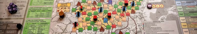
Esta versión 4.0 del tablero es el resultado de muchas, muchas horas delante del mismo. Todo empieza con ideas. Personalmente me dejo llevar por lo que quiero ver en él, las cosas que creo que transportan el peso de lo que quiero contar, y lo hacen en un principio sin más guía que un «A ver, por ejemplo esto aquí, y esto allá… sí, más o menos«. Poco a poco, esa improvisación va dejando paso a un ajuste grueso, que cercena partes del mismo y añade otras que suplantan sin escrúpulos lo que en un principio parecía inamovible. Finalmente, cuando uno ya tiene el concepto bien definido y el cuerpo del juego es robusto, llega el ajuste fino de todas las variables: elegir estética, hacer cuentas, equiparar tipos, equilibrar números… Obviamente mi prototipo no cumple las leyes fundamentales del diseño gráfico más chapucero, pero detrás de una cara sucia y barata, está la maquinaria que espero que un buen diseñador o diseñadora consigan plasmar con su arte.
Dejo aquí una muestra de la evolución que ha seguido el mapa, el tablero y el concepto. Creo que es bonito ver el desarrollo de un diseño, cómo va mutando, reconduciéndose, tomando y soltando, para poder tomar perspectiva del trabajo que hay detrás.


—
Termino aquí el repaso del mapa de Guerrilleros agradeciendo a todos/as los que habéis leído esta nueva entrada y animándoos que dejéis cualquier cometario/pregunta/sugerencia en la sección de comentarios de la misma. ¡Gracias!
– Pablo, autor de Guerrilleros
Para ayudar a que Guerrilleros sea publicado, puedes inscribirte en el programa P500 de NAC Wargames de forma gratuita y sin compromiso de compra.
Entra en la web dedicada a Guerrilleros y haz clic en el botón «Apúntame» (sólo necesitarás una cuenta de MasQueOca, ¡es fácil!). ¡Muchas gracias!
English version
Guerrilleros is a strategic scale game where the main ‘theater’ is peninsular Spain. In this entry I will describe the central area of the game board. That is, the map, its structures, its omissions and its optimization along the iterations it is undergoing as I develop the game. I will leave for a later entry the external zone of the board which mainly contains tracks referred to the different strategic aspects of both sides.
IMPORTANT: everything I describe below is work in progress. Therefore, the main body of the game is FINISHED:
- The main body of the game is FINISHED – unless something comes up that forces a revision.
- The mechanics are robust but are OPEN to be polished as we test the game and find gaps or situations that may cause unwanted imbalances.
- The graphic design is NOT FINAL so none of the images you will see below are in their final version. All components will have a much, much better design than what you will see in these diaries.
- Language related, all you see written in Spanish will be FULLY translated to English for the final version so you can count on a complete English version of the game (rules, components, cards, map… everything!).
That said, if you want to know more about the game board, keep reading!
The game board of Guerrilleros
Among other things, making a good board for a game is an tough task, one that I don’t consider myself particularly good at. The design I show below is provisional and clearly improvable. However, for the purposes of this (long) stage of game development and testing in which I am immersed, I think it is sufficiently functional as it contains all the essentials. I must also add that for its final design, a good graphic designer will improve it by several orders of magnitude.
In this version (number 4.0, far from the initial concepts and the one NAC got interested in), I have divided the board into two areas: the central area (map of Spain) and the outer area (tracks and boxes).
In this entry, I will talk about the central area, the map of Spain and its characteristics. The outer zone will be dealt with in a future entry, together with the explanation of some of the game mechanics.
The map of Spain
Focusing on the map and its spaces, this zone constitutes the main playing area where units of both sides will be distributed, move, fight, and flee.
The map shows different elements: fronts, areas and roads.
MAIN FRONTS: NORTHERN, CENTRAL AND SOUTH
La actividad del Maquis no se definió en «frentes» como los que presento en este mapa con un sombreado de color rojo (Norte), amarillo (Central) y morado (Sur). Históricamente, no hubo frentes con sus líneas de frente, retaguardia, línea de suministros, etc., sino extensiones de diferente tamaño y orografía donde los guerrilleros se escondían, realizaban su actividad y que variaron mucho con el paso de los años.
Maquis activity was not defined in «fronts» as shown on this map with red/North, yellow/Central and purple/South shading. Historically, there were no fronts with their proper front lines, rear lines, supply lines, etc., but extensions of different sizes and orography where the guerrilla hid, carried out their activity, and which varied greatly over the years.
It is important to add that among the different sources I have consulted there is no single, precise and unanimous version of what are considered the areas of Maquis activity. For that reason, in this map I have chosen to use the fronts as a synthesis of both facts: one, that the areas of activity were concrete, more local than global, and two, that there was enough Maquis presence in so many areas of different sizes (even if only for a short time) that it is difficult to demarcate them into very specific areas.
Moreover, using this ambiguity as a pretext, I have allowed myself to extend the ‘borders’ of these fronts, with no other objective than to facilitate the experience of the game.
Finally, I have tried to make the map subtly contain the information of historical and non-historical activity zones: on each front, the historically accurate areas are delimited by a solid line and a more saturated colour, while the areas deliberately extended by me have a softer colour and are delimited by a dashed line.
Then, what is the role of the fronts?
In Guerrilleros, these fronts are a convenient geographical approximation to improve gameplay and add the ‘local’ component of the activities of the different Agrupaciones Guerrilleras (guerrilla groups, abbreviated as AG). The fronts are irrelevant to the Regime, which can (and should!) ignore it except for a few points.
In short, the fronts represent the zones in the map that share several properties and characteristics that mainly affect the Maquis side, and that I list below:
- BLOCKS DEPLOYMENT. The Maquis AG parties from each zone of Spain are deployed in their respective front (indicated in each block): those from the North of Spain are deployed in the Northern Front, as well as those from the Central and South in their respective fronts.
- COMMON PARAMETERS. There are certain parameters that are abstracted and collectivised, such as Resources or Armament, available and shared by all the Maquis parties on the front. These parameters are intended to average the logistical and military capacity of the AG parties of the front, and are not intended to suggest that there was a large common logistical or armament infrastructure for large areas, let alone the size of a front. They simply aggregate the dwindling capabilities of the Maquis parties over time.
- MANOEUVERS. When playing Manoeuver Cards, the main engine of the game, manoeuvers can be assigned to each front, to be resolved later.
- POSSIBLE VICTORY CONDITION FOR THE REGIME. The fronts also constitute strategic elements for the Regime side, which can win the game if it manages to eliminate the last Maquis block in two of the three main fronts.
The Pyrenean front will be described next. After that I will describe the types of spaces on the fronts.
TEMPORARY FRONT: PYRENEAN
The nature of the Pyrenean Front is special, or rather ‘temporary’. The opening of this front occurs if the Maquis invasion of the Vall d’Aran, also known as ‘Operation Reconquest of Spain’, is carried out. In the game, this operation is usually initiated by the Maquis, although the Regime can also force its detonation.
The moment this operation begins, all other fronts are put on hold and the attention is exclusively on this temporary front until the operation ends (as indicated by the ‘Pyrenean Front Abandonment’ track). This break in the regular game is due to the fact that Operation Reconquest of Spain lasted only a few days, from 19 to 24 October 1944, and this time span does not fit the normal game rounds, set at 6 months each. Therefore, for the next three rounds (while retaining most of the structure of a normal round), only the Maquis partidas and Regime patrols of the Pyrenean Front will be used to play. The Pyrenean Front closes at the end of the last round of the Abandonement track. Then, the Maquis partidas that have successfully left it can continue playing in the rest of the fronts, while those that have not left it will be eliminated. The Regime will recover the patrols of this front by sending them to the Reserve. Then, the game is resumed by starting the next round, playing it as usual.
One of the Regime’s victory conditions is to eliminate the presence of Maquis partidas in two of the three main fronts (N/C/S). Therefore, I stress the temporary quality of the Pyrenean Front as well as the fact that it does not count for such victory conditions.
MAP SPACES: AREAS
The different coloured and outlined locations make up the spaces where the game’s partidas and patrols will be placed. In the game they are called ‘areas’ because they represent actual areas of between 5 and 10 km radius around the name written on the space. That is, each area should be understood NOT as the location mentioned in it but as the immediate vicinity around that place, a variable square km extension around each area.
For example: ‘Dobro’, a rural town in Burgos on the Northern Front, does not refer specifically to the village of Dobro as such, but should be understood as the vicinity of Dobro.
TYPES OF AREAS
Having clarified the scale of the areas, I continue by describing the types of areas that can be found on all the fronts:
RURAL POPULATION area, in light orange colour, they represent areas around small villages, generally sparse of Maquis relevant actors or geographical areas. In the image: El Barco de Ávila or Navalmoral de la Mata.
VILLAGE area, in red colour and representing extensions around villages of greater importance or relevance for the purposes of the Maquis (provisioning, propaganda…). In the image: Trujillo.
CITY area, coloured in blue and with a number representing the city’s intrinsic Regime forces as well as potential Victory Points. Offensives (Maquis attacks to relevant city infrastructures to receive VPs) can only be conducted in spaces that have a value, i.e., all cities and Viella (Pyrenean Front). In the picture: Cáceres.
HILLS area, green in colour, representing areas around settlements of variable size and always with a high and relevant presence of mountains around them, key for the Maquis. In the image above: Béjar, Plasencia, Serradilla or Cañamero.
HIGH MOUNTAIN area, brown in colour, accessible only by the Maquis and requiring expenditure of resources or one step loss. In the image above: Sierra de Gata.
REGIME HEADQUARTERS areas, indicated with a red arrow mark containing a white ‘C’, present in all cities and some towns. These are the areas where the Regime can deploy patrols from the Reserve. In the image above: Cáceres.
Areas with the presence of one or more surrounding fast-flowing RIVERS, indicated with a blue symbol to the top-right of the space. They only affect the movement of the Maquis partidas, and can be ignored by the Regime’s patrols. In the image above: Plasencia or Serradilla.
SPECIAL areas, indicated with a yellow border. There are two in particular: Madrid (Central Front) and Viella (Pyrenean Front). These are possible scoring areas that can be part of a Maquis Offensive only if the right conditions are met. These conditions are indicated on some of the cards and both areas remain out of play until they are drawn and their effects carried out. In the image on the left: Viella.
CITY WITH PORT areas, indicated by an anchor symbol and an arrow indicating the possibility of exile for Maquis partidas that make use of it. In the image on the right: Algeciras.
CONNECTIONS BETWEEN AREAS AND FRONTS: ROADS
The direct connections between two areas of the same front (adjacent areas) are indicated by dark blue lines. These connections can be used by both sides. Despite they do not represent any particular path, road or roadway, they are arranged between relatively close areas. If an area does not have a road leading to another apparently close area, it is likely that either the areas are not as close as their location on the map would suggest, or there is some geographical feature that makes their transit difficult to the point of making such a route unfeasible.
Called roads for simplicity’s sake, connections between areas of two different fronts (areas NOT adjacent) or inter-front connections, are indicated by brown or purple lines. These connections can have one or two sections. They are passable only by the Maquis side and represent the only suitable way for a Maquis partida to travel from one front to the other. Road sections are defined as the portion of a road between an area and either a) another area, or b) a nexus (black core circular figure; it does NOT count as an area but just a road splitting element). Each road section represents a ‘space’ on the road, so the Maquis side must spend manoeuvre points just as usual to move the partidas across each road section, and until they reach the destination area.
In turn, the Regime ignores the roads. This has an obvious logic behind: the Regime controls the full Spain and its infrastuctures so they can move the patrols around the map unrestrictedly. To move patrols from any space on the map to another from a different front, it must use the Deploy manoeuvre twice to, first, move troops to the Reserve and second, deploy those or other troops to any other area of the board containing a Headquarters marker.
In addition, the Regime may establish road Checkpoints (Control) or Roadblocks (Bloqueo) in road sections that respectively hinder or fully prevent the movement of the Maquis partidas through them.
The purple roads are exactly the sameas the brown ones, with the particularity that they are only passable once and in the direction indicated by the arrow, acting as the escape routes of the Maquis partidas after the detonation of Operation Reconquest of Spain. Likewise, the Regime’s side will only be able to establish Checkpoints or Roadblocks in them during the rounds in which the Operation is carried out.
MAP OMISSIONS
I have not received any comments on this, but I want to address this issue clearly and before anyone misunderstands anything about it: the game does not contain all the knowledge, facts, places or elements of the Spanish guerrilla warfare. And that is fine.
A few paragraphs above I mentioned my decision to group the different areas of guerrilla activity into what I have called the Northern, Central, Southern and Pyrenean Fronts in order to favour playability. With this decision in mind, I am aware that I have left out of these borders many places where the Maquis was present and active, regardless of their intensity or extent: Balearic and Canary archipelagos, inland or coastal areas with more localised activity, etc.
Behind the decision to omit places where there could have been or certainly was guerrilla activity there are no further intentions beyond that of setting limits to the game – just like any other game. Therefore, such omissions are devoid of any geographical, ideological or any other kind of nuance.
In short, the game design dictates its own limitations (and that’s good!). Some of them can be overcome, but others require sacrifices. The path that I am following for the design of Guerrilleros prevents me from reaching a level of historical exhaustiveness that would cover all Maquis presence in Spain. Instead, I am trying to offer a functional game, synthetic but with historical depth, which I consider fun and VERY open to achieve a high replayability.
So, dear reader, if I have omitted the experience of your town or village, that of your ancestors or acquaintances, I have no issue stating that I am sorry, although it was not deliberate towards any of them. In return, I can confirm, with my hand on my heart, that this game is intended to honour the historical memory of all those who took part in this unfortunate and desperate episode of our recent history, whether or not they are reflected on the map or charts. I hope that this is how you and everyone else who plays Guerrilleros will understand it.
Optimisation across versions
This 4.0 version of the board is the result of many, many hours in front of it. It all starts with ideas. Personally I let myself be carried away by what I want to see on it, the things that I think carry the weight of what I want to express with the game, and this usually happens at first without further guide than «Let’s see, for example, this goes here, and this goes there… yes, more or less«. Step by step, this improvisation gives way to a broad adjustment, which cuts out parts of it and adds others that unscrupulously supplant what at first seemed immovable. Finally, when the concept is well defined and the body of the game is robust, the fine tuning of all the variables arrives: choosing aesthetics, doing math, matching types, balancing numbers… Obviously my prototype does not comply with the fundamental laws of the most shoddy graphic design, but behind a dirty and cheap face, there is the machinery that I hope a good graphic designer manages to capture with their art.
I leave here a sample of the evolution of the map, the full board and the concept behind it. I think it is nice to see the development, how it mutates, how it is re-directed, taking and letting go, to be able to take perspective of the work behind it.
—
I end this review of the provisional Guerrilleros map by thanking all of you who have read this new post and encouraging you to leave any comments/questions/suggestions in the comments section of this post. Thank you!
– Pablo, designer of Guerrilleros
And remember, you can help get Guerrilleros published by signing in to NAC Wargames’ P500 program for free and no purchase obligation. Just enter the dedicated P500 website and click on «Apúntame» button (you will need an MasQueOca account, easy peasy). Thanks!
Buenas tardes.
Cuando saldrá a mercado?
Cuál será su precio.
Hola Roberto! Gracias por las preguntas!
SOBRE LA FECHA DE PUBLICACIÓN:
La respuesta rápida es que no lo sé, ni yo ni siquiera la editorial.
La respuesta larga es que la fecha no está determinada aún para este juego ni para ninguno de los que pertenecen al programa P500 de NAC. Esto se debe a que son juegos que la editorial desea publicar pero, para ello, necesita la medida del «termómetro» del interés general (como el tuyo) para decidirse. En pocas palabras, necesita saber si el juego ha causado suficiente interés como para que varios cientos de personas se hayan interesado en él y le hayan dado al botón de «Apúntame» en la web dedicada al juego:
https://www.masqueoca.com/tienda/producto.asp?item=10177&tit=Guerrilleros%20El%20Maquis%20espa%F1ol%20en%20la%20posguerra
Por tanto, cuantos más os apuntéis, ¡antes podremos dar respuesta a tu pregunta!
SOBRE EL PRECIO FINAL DEL JUEGO:
Como imaginarás después de la respuesta anterior, la fecha de publicación y el precio tienen destinos similares. En cuanto la editorial encuentre suficiente interés y respaldo del público en forma de «reservas», podrá poner fechas y precio al juego.
Yo me mojo: ojalá sea el más económico posible siempre ofreciendo un juego de alta calidad a todos los niveles (experiencia, materiales, etc.), que es lo que suele hacer NAC. Sin confirmar absolutamente nada (no tengo ni idea!) yo esperaría que estuviera en la media de los precios que ves de los juegos publicados por NAC. 😉
Espero haber explicado lo mejor posible ambos puntos, si bien no he podido darte respuestas específicas a tus preguntas. ¡Un saludo!